Bound for Miyakojima - II
Wow! so much colour!
This the second part of my travel blog of going to Miyakojima in December 2022.
Having taken off from Haneda International Airport Terminal 2, my ANA A321 flight skirted along the coastline over some recognizable landmarks for the first little while before heading out to the open waters of the Pacific Ocean. I had chosen a seat in front of the wing and on the right side of the plane to take advantage of the views while flying.


In the first image above, the little island connected by a narrow path to the mainland is Enoshima. It is located in Kanagawa which is not far from Yokohama. Kanagawa is famous for many things including a Giant Buddha in Kamakura. The other famous thing in in the area is the “Enoden” or the Enoshima Electric Railway. It is a local tram service that connects 15 stations together and stretches from Fujisawa Station to Kamakura Station. One of the stations that many people get off is to go visit is Enoshima Island. In a future blog post, I will talk more about my visit there as it was a fun day trip from Yokohama.
The second image is of course, Mount Fuji. I think I have seen it from every direction and angle other than up close. I will have to make a future trip to one of the Prefectures where I can see it up closer.
The third image is a photo taken later in the flight and shows a part of the wing tip of the A321.

Google Maps sample flight from Tokyo to Miyakojima
A quick visual of the estimated flight path to Miyakojima. Even though, Google Maps says it would take 3 hr 15 minutes, it really did not feel like that. The A321 that I was in felt relatively new. The tv display even had the functionality to see outside either in front or below the airplane through one of two cameras. Although, there was no meal service, we did get a round of drinks served when we were in the air. One of the silly things that I thought of to entertain myself was the idea to make an animated gif my cup. ANA was promoting the animation ‘Kimetsu no Yaiba’ or ‘Demonslayer’. Since the cup had a beautiful design, I thought it would be to fun to try to see how successful I would be. It was fun, but difficult to manipulate the cup with my right hand, keep it in the same relative position, and not move my iPhone which was being held in my left hand. I took a few sequences to see how close I could get and this is the sequence I chose.

My dancing empty cup was made from eleven individual photos from my iPhone 14 Pro.
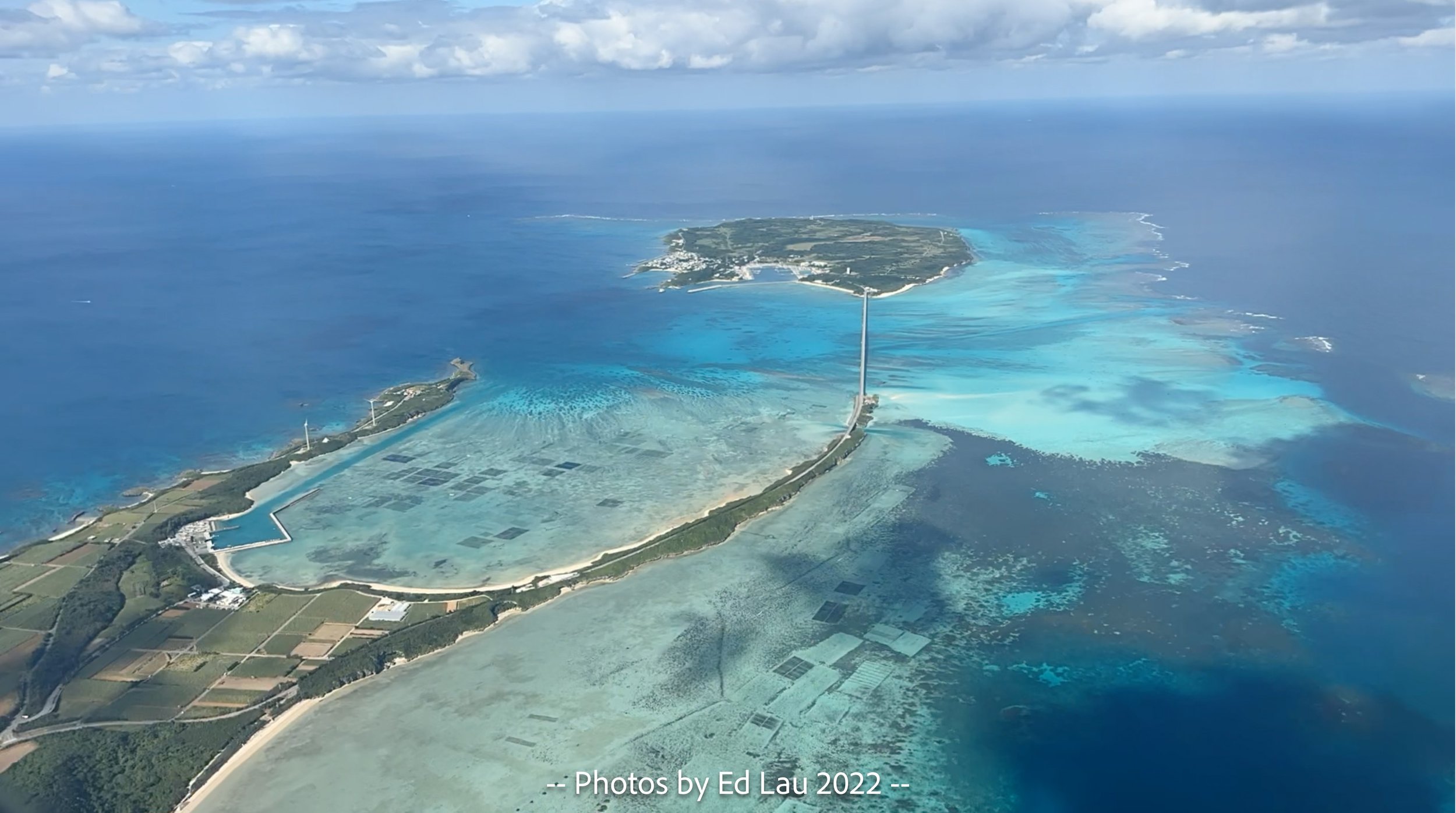
After nearly three hours, we were now approaching the coastline of Miyakojima quickly with a Ikema Island featured above and Irabu Island below passing us by in a blink of an eye. Along with Kurima Island, which is a small island at the bottom of the Google Earth map of Miyakojima, are the three satellite islands of Miyakojima. All three are connected by a bridge which is scary to drive at night as it is a straight two lane highway surround by water. In the last photo of Irabu Island is a long runway that belongs to the Miyako Shimojishima Airport and 17 END. This was not the airport that we would land at. Miyako Airport is actually on the main island of Miyakojima and is located almost where the words ‘Miyakojima’ are located on the map. Soon, very soon, we will be landing and I will need to gather my suitcases and transportation situation.


Flying over Irabu Island on the way to land in Miyakojima.